Jet stream effects on Californian wildfires and rainfall
Fierce winds blow around the Earth, high up in thin, cold air. Far above the level of the highest mountain peaks, at a fifth of sea-level air pressure, it was only when weather forecasters started releasing balloons that they could study these winds directly. But for something so inaccessible, these winds determine weather patterns over huge areas. A belt of these high fast winds is known as a jet stream.
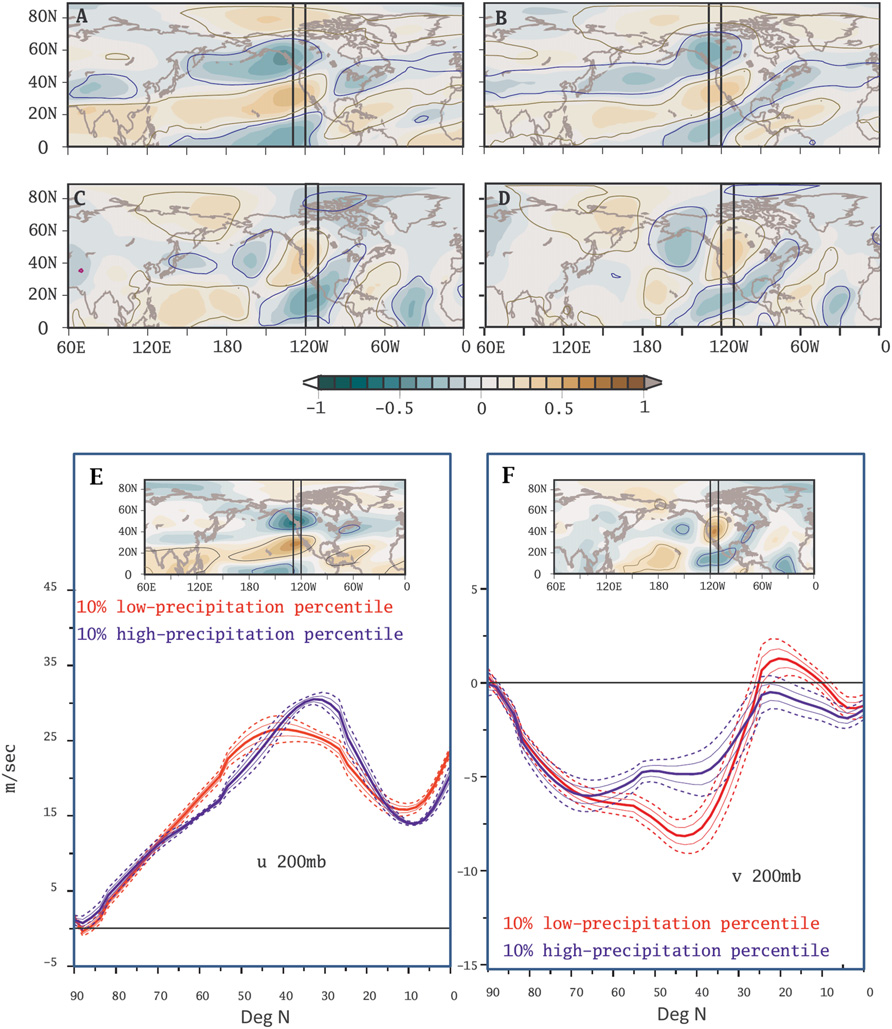
A group of researchers including Valerie Trouet of the LTRR wanted to find the effects of the winter jet stream in the north Pacific on California during the last few centuries, in particular on the amount of rain and snow falling there, and on the frequency of wildfires. With the unprecedented recent Californian drought being followed by near-catastrophic floods, and the devastating fires of the past couple of years, this is obviously something of great practical importance. Because direct measurements of the jet stream have only been possible recently, they had to resort to other methods for earlier times. Fortunately the very thing that makes the jet stream interesting—its effects in large-scale weather patterns—means there is plenty of evidence to infer what it is doing. For recent periods the many other weather observations are of use, and for earlier periods the reconstructed weather data from evidence such as the patterns of tree rings work as well. The researchers found that the different strands of evidence told a consistent story from the start of the reconstruction through the middle of the twentieth century. They looked at the speed of the jet stream along narrow zones stretching from the North Pole to the Equator and passing close to the Pacific coast of North America, considering not only the main west-to-east average wind direction, but also the average winds in the north-south direction (which are significant for loops in the jet stream, where the wind veers south then north again). For most of the past few centuries a strong jet stream positioned relatively far south has meant a wet California, with relatively few wildfires; a weak jet stream vaguely positioned further north has meant drier conditions, and more wildfires. A previous study with some of the same authors had shown that direct human effects on the landscape had affected patterns of wildfire more than changes in climate: the jet stream reconstruction included a separation into these phases of human activity. The reconstructed rain and snowfall was consistent through all the phases from the start through the mid-twentieth century, although the effects on wildfires weakened during the period after 1900 (when the Forest Service and others waged a successful campaign to snuff out most fires as soon as they started), and broke down completely after 1977. Projections of climatic change through the twenty-first century could imply a more fundamental breakdown in the relationship between the positioning of the jet and wildfires, with generally warmer conditions leading to more moisture arriving as rain rather than snow, and forests drying out earlier in the year. The reconstructions have almost no years which were both wet and had many wildfires, but this has already happened in 2017: the final breakdown may have begun.


